After decades of debate over its position, the city of Alexandria on the Tigris re-emerges, an important port hub founded at the end of the 4th century BC during the campaigns of conquest of the Macedonian leader Alexander the Great (356 BC–323 BC). Alexander the Great founded numerous large cities, some of which still exist and thrive such as Alexandria in Egypt, and some abandoned over time. The latter is the case of Alexandria on the Tigris, whose ruins are located in the south of present-day Iraq, near Jebel Khayyaber (near the border with Iran). Archaeologists have found the remains of the urban center that must have served as a connection between Mesopotamia and the Persian Gulf. The river trade networks mentioned were vast, allowing trade between India and Central Asia.
The city, later known as “Charax Spasinou”, was founded at a time of great expansion of long-distance trade. In fact, between 300 BC and 300 AD, spices, fabrics, semi-precious stones and metals were transported to the main Mesopotamian cities (such as Seleucia and Ctesiphon), so a port at the crossroads of sea and river routes was an excellent transit point. This determined the fortune of the settlement, at least until the Tigris moved west and the city was largely abandoned.
News of the find was announced in January by the University of Konstanz in Germany, whose Professor Stefan Hauser, chair of Mediterranean and Near Eastern archaeology, is leading the archaeological initiative to document the site.
The study retraced more or less modern sources to find the city: the oldest (including Pliny the Elder) traced its position to the northern end of the Persian Gulf. By studying ancient sources and aerial photographs taken in the area by Royal Air Forcethe British researcher John Hansman found an enormous city wall and traces of a settlement in this area in the 1960s. The necessary field research, however, was made impossible by the geopolitical instability of the area, which resulted in the war between Iraq and Iran.
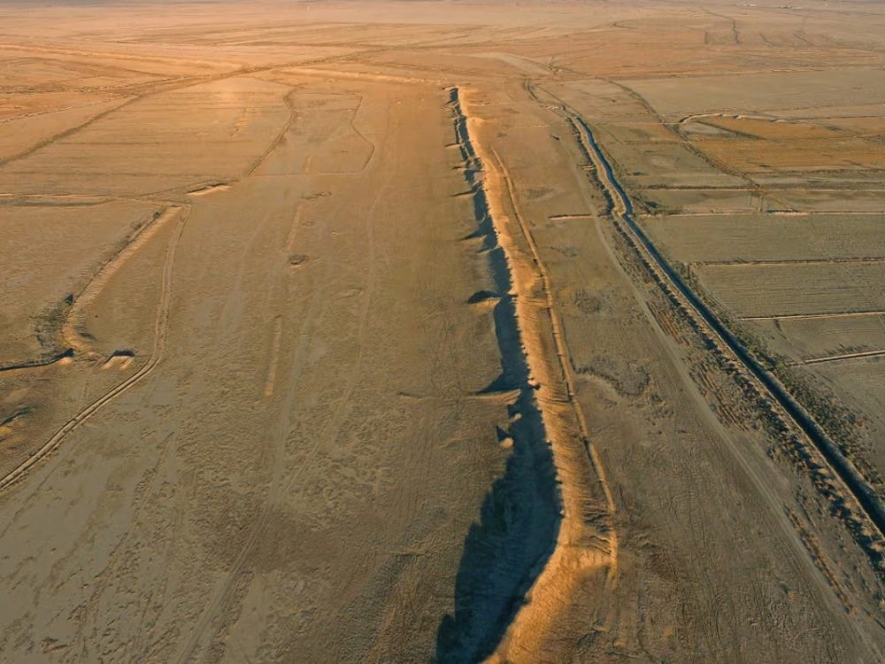
This was until 2014, when some English research teams finally returned to the site, joined in 2016 by Hauser, giving life together with them to the Charax Spasinou Project. At that point, always working under armed guard, the researchers found the low ridge in the plain which turned out to really be a city wall, over a kilometer long and up to eight meters high.
The incontrovertible presence of an important urban center had finally emerged. Since that time, researchers have covered over 500 square kilometers on foot and taken thousands of aerial photographs via drones. These works led to the discovery of numerous fragments of ceramics, bricks and industrial debris and to the construction of a detailed model of the terrain. On this basis, geophysicists have used magnetometers to map the buried structures.
What emerged was a grid city, with wide streets, even very large residential blocks (larger than most of those present in other contemporary cities) built near religious buildings, industrial sectors and workshops with furnaces built near waterways, canals connected to vast agricultural fields (which would have supported a considerable population) and port basins. In short, everything you could expect from a city that has been at the center of trade between the Middle and Far East for centuries.