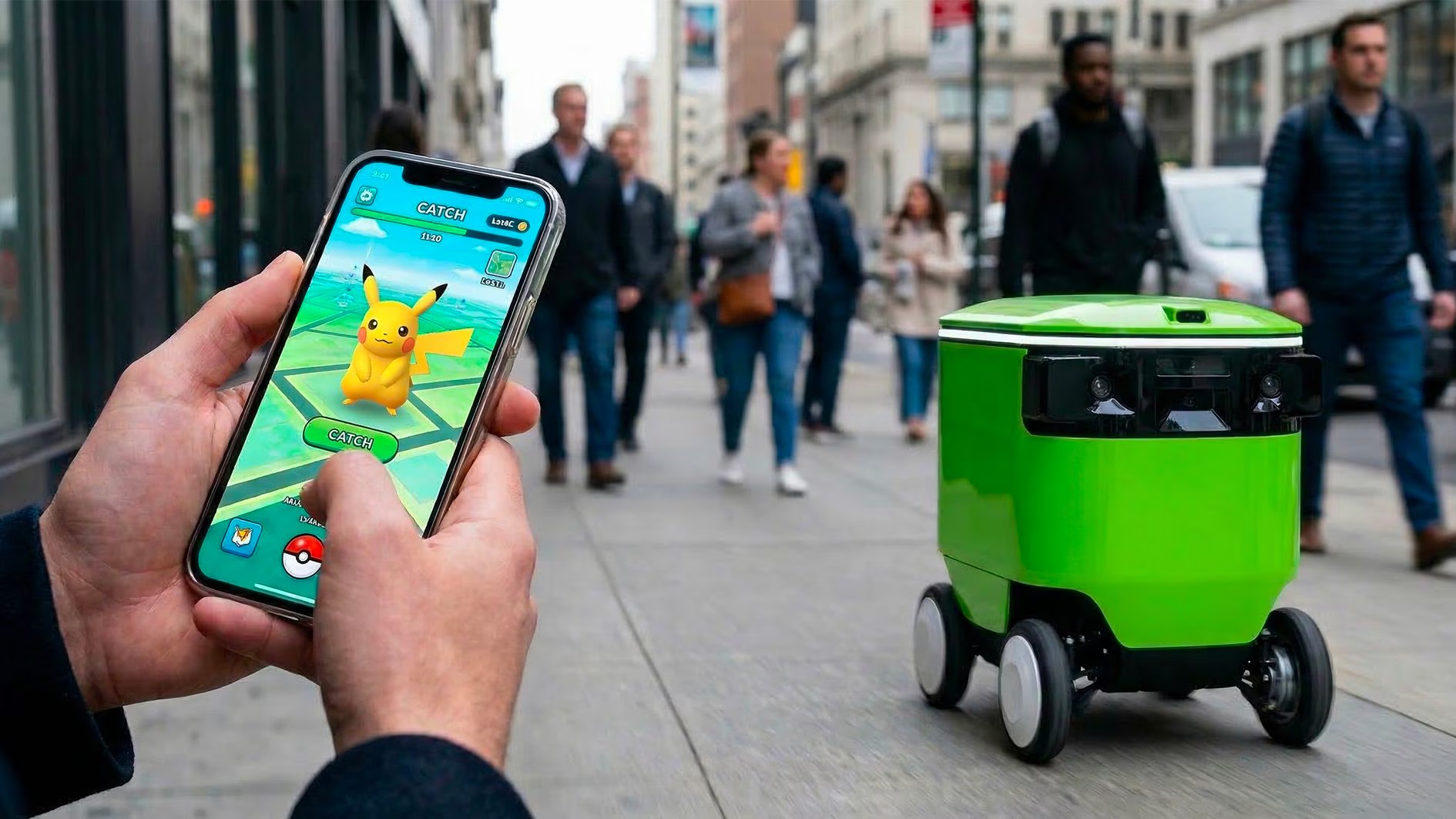
If you have been among the 700 million Pokémon Go players over the past decade, you too have helped train a geospatial artificial intelligence that is then used to create 3D maps to drive delivery robots. Between chasing a rare Pokémon in their city and framing a square to interact with a “virtual gym,” users who played Pokémon Go captured extremely valuable images and information about the space. But precious to whom? For Niantic Spatial, a division of Niantic (the company that still develops the game today), they used this information to power an extremely precise navigation system. The result is software capable of precisely locating devices and robots in the real world using not only satellite coordinates, but also visual elements of the surrounding environment. In practice, what was a simple pastime for many users (and still is for those who play the title) has become a fundamental piece in the development of artificial intelligence models that allow machines to orient themselves in physical space. Which machines? Those of Coco Robotics, which develops delivery robots and which will use the Niantic Spatial platform to precisely guide its robots in the crowded cities where it offers its services, including Los Angeles, Chicago and Helsinki.
Pokémon Go and Niantic’s AI: 3D mapping with 30 billion images
Since 2016, the year the game was launched, over 30 billion images have been accumulated from streets, parks and public places collected through AR features and in-app interactions. This huge archive is the basis of what Niantic calls an LGM (Large Geospatial Model), that is, a large geospatial model: an artificial intelligence structure trained to understand physical space through visual data. In this way the software is not only able to know where an object is located on a map, but is also able to recognize it, interpret it and place it in the context that surrounds it.
The heart of this technology is VPS (Visual Positioning System), a positioning system that uses images instead of satellite signals. Unlike GPS, which relies on data from space, VPS analyzes details such as buildings, signs or monuments to determine location and orientation. This approach is particularly effective in complex urban or indoor environments, where the satellite signal may be inaccurate or unstable.
This technology is now at the center of the collaboration with Coco Robotics, a startup based in Santa Monica (California), founded in 2020, specializing in robotics for urban food and grocery delivery. We are talking about small autonomous vehicles on wheels that move on pavements and which have to deal with extremely variable scenarios: pedestrians, obstacles, intersections and continuous changes in the environment. By integrating GPS and VPS, these robots can significantly improve their orientation ability and reduce localization errors.
What Pikachu has in common with delivery robots
John Hanke, CEO of Niantic Spatial, stated regarding the matter that «The potential of last-mile robotics is enormous, but the reality of navigating chaotic city streets is one of the toughest engineering challenges» and then added that «making Pikachu run realistically and making Coco’s robot move safely and precisely through the world are actually the same problem».
Hanke says something interesting, which is that making a virtual character move believably in real space and driving a physical robot through the streets of a city share the same engineering problem: understanding and interpreting three-dimensional space in real time. This is where the value of player-collected data comes in, offering an extremely detailed and up-to-date representation of the world.
A significant portion of this information comes from game-specific features, such as augmented reality, or AR, scanning activities. In these cases, participation was explicit: users had to activate the function and agree to upload the content. Niantic said it has maintained transparency around these processes, making contributions optional and informing users about data use (at least from 2019 onwards).