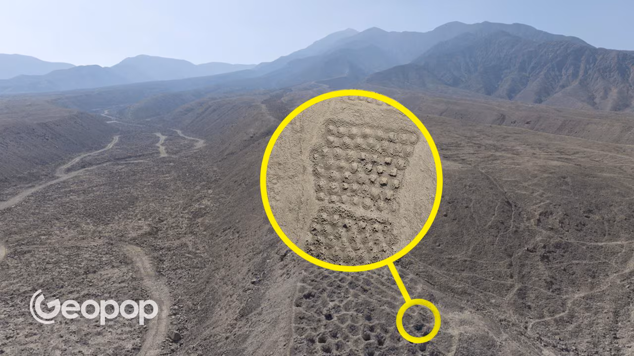
In southern Peru there is the archaeological site of Monte Sierpe, one of the most particular and mysterious in South America, with its band of holesor “gang of holes”. These are more than 5200 holes dug in the ground on a barren ridge of a hill in the Pisco Valley and perfectly aligned with each other to create a band over 1 and a half km long.
For a long time we wondered what it was for and what period it dates back to, and a study conducted by a group of American, Peruvian, Australian and British researchers shed light on the question. According to this study, Monte Sierpe was first a market, in which the holes, one meter wide, were used to deposit foodstuffs according to a very specific order, and subsequently, in the Inca era, a place where the accounting of tributes was carried out with a numerical system similar to that of the quipu.
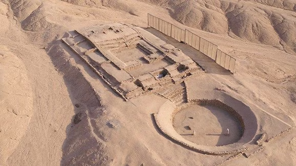
The site is located in an area of the coastal desert of Peru, 35 km from the sea and 1 km from an ancient fortified settlement. Monte Sierpe, the name by which the locality is known, derives from a hacienda (a farm from the Spanish colonial period) which grew vines on this hill in the 18th century.
Naturally, his acquaintance began much earlier. The researchers, to date the phases of use of the over 5200 holes lined up on the mountain, used two methods. The first was a surface survey, during which fragments of ceramic dating back to between the 11th and 16th centuries were collected. The second was radiocarbon, starting from a fragment of coal coming from a hole, which returned a dating to the full 14th century. This is a phase of use compatible with that of the nearby fortified settlement.
However, the parts of the study that returned the most interesting results were the archaeobotanical analysis and the GIS surveys carried out with drones.
Archaeobotany is a discipline that deals with studying plant remains from archaeological contexts. This is a study approach that allows us to understand what types of plants man exploited in the past and in what way.
The researchers took 19 samples from the sediments in the holes (these have a width ranging from 1 to 2 meters and a depth ranging from 1 meter to half a meter), and these were subjected to microscopic analyzes carried out in two separate archaeobotany laboratories, one belonging to the University of South Florida, and another of the Peruvian Cayetano Heredia University.
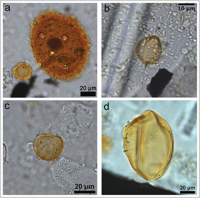
Starting from the sediment collected in the samples, archaeobotanists were able to identify remains of seeds, pollen and other plant elements which allowed them to reconstruct which species were cultivated or collected. Drone flights have instead made it possible to identify gods patterns recurring numbers in the layout of the holes. In fact, it would seem that the number of aligned holes is not random, but made up of a varied alternation of rows made up of 7, 8 or 9 holes, alternated or repeated.
According to Jacob Bongers, of the University of Sydney, coordinator of the research group that studied Monte Sierpe, the alignments of holes served to store plant resources in what was probably a large market.
The area in which Monte Sierpe is located is very arid, consequently the pollen and plant traces found in the sediment samples from the holes could hardly have come from vegetation in the area. Consequently, it is much more likely that they come from plants deliberately placed inside the holes, also because among the species detected there are some typical of the coast.
Furthermore, the site was located in a strategically important area for trade in the pre-Inca era. In fact Monte Sierpe was at a key junction for an important road that connected the coast with the valleys and plateaus of the Andes. In a pre-monetary economy based on barter, the number of occupied holes, like a numerical code shared by the community (very similar to that used in quipu), could have served to give potential buyers information on the type of goods and its quantity. At the time there was no writing as we understand it, but the Incas were able to administer an immense empire by transforming the landscape itself into a gigantic “accounting ledger” in the light of the sun.
This market function would have been fulfilled during the period of the Chincha kingdom, a state structure that dominated this area of Peru in the 14th century. In the 15th century the Chincha, like much of present-day Peru, were subjugated by the Inca. During the Inca period of Monte Sierpe (15th-16th century) the numerical calculation of the holes also served another purpose. To count and catalog the tributes that the Chincha owed to their new rulers, the Monte Sierpe holes could have served as a large calculator, where certain goods and their number could be expressed through the patterns numbers of occupied holes, in a huge accounting system, a sort of gigantic quipu.