We usually open Google Maps to search for our next destination, a restaurant or to check traffic conditions. During the summer season, however, the application can transform into a very useful tool for monitoring fires and protecting our safety and that of our family. Before seeing how to take advantage of this function, it is good to remember one fact. Despite the high technology used, it must always be remembered that digital maps are not infallible. The actual area affected by the fire may differ by several kilometers from that drawn on the phone screen. For this reason, use Maps as a cognitive support, but for your safety always and exclusively rely on the information provided by the local authorities and the Civil Protection on site.
How the map works
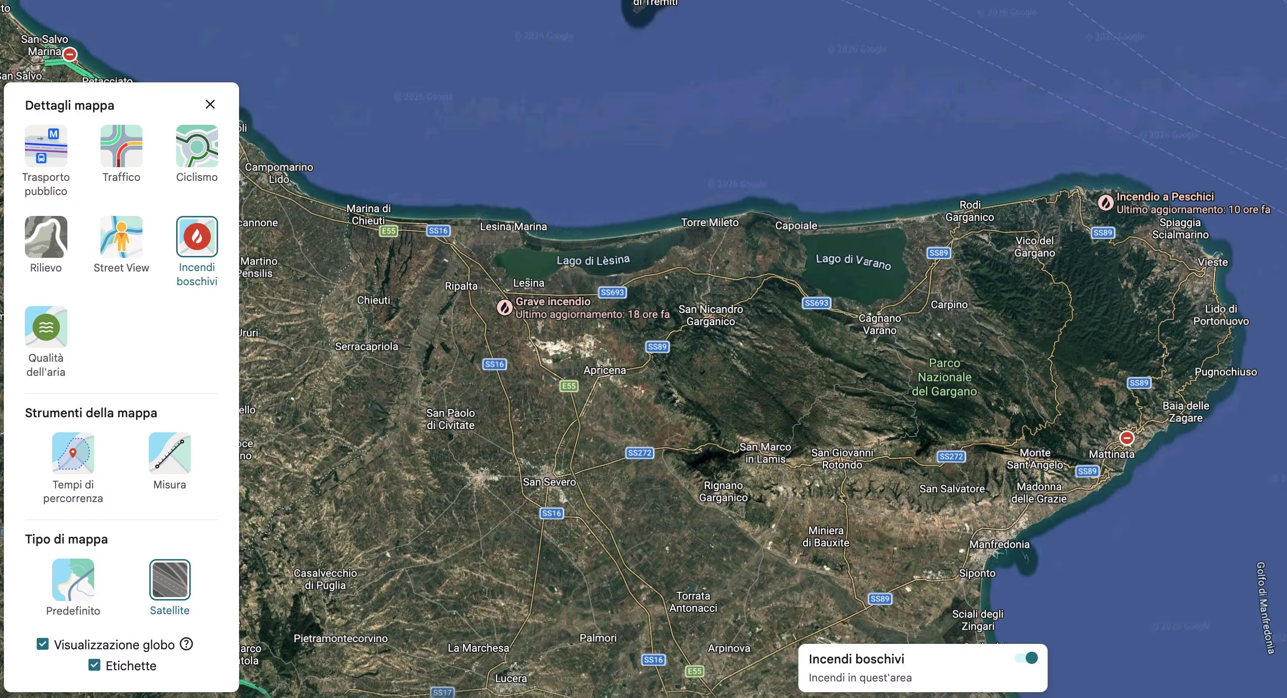
To access fire data with Google Maps you have three ways available. The first consists of opening the app, tapping the Layers menu (the icon with the two overlapping sheets at the top right) and selecting the Forest fires item. In the Fires in this area menu that opens, the fires in the vicinity will be listed and, by tapping one of those listed, useful information will be provided in this regard, for example relating to closed roads and updates available from the authorities (for example via their official social profiles).
Otherwise, you can type keywords like “fires” or the name of a specific fire directly into the search bar. Otherwise, by setting a route via the Directions function of Google Maps, if there are fires along the route to travel, you will see a banner appear which can be clicked for information on the matter.
Note: If no fire information appears at a certain zoom level, try zooming in on the area on the map to see it.
Graphically, fires are marked with a specific icon or a red circle. Around them you can notice two types of colored areas: the red shadings, which delimit the areas in which the presence of the fire is confirmed, and the yellow shadings, where the event is reported with a lower margin of certainty.
Google obtains these maps thanks to satellite sensors, tools capable of capturing thermal images (i.e. photos that detect variations in heat on the ground) and recording changes in the landscape. These systems have spatial resolution limits and for this reason risk underestimating the real size of the fire.
Where does the data come from to report fires on Google Maps
The data you see on the screen comes from the union of different institutional sources and advanced technologies. Google collects information from the NIFC, the National Interagency Fire Center US, through the WFIGS geospatial service, which traces the exact point of origin of the fire via a dot on the map. Among these you will also notice prescribed fires, i.e. fires planned and controlled by the authorities to clear the undergrowth and prevent much more devastating fires (fires smaller than two hectares, however, are not shown). Added to this are the meteorological surveys of international agencies such as the American NOAA, the NMSC and the Japanese JMA. Everything is processed together with SOS Alerts and Google Alerts, which scour the Web, social media and official channels to show information sheets complete with updated news and fire containment status.