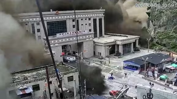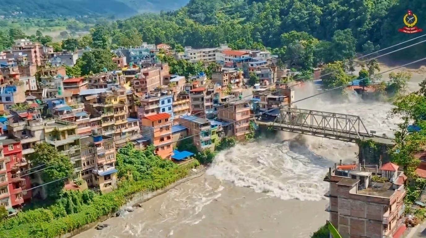
Rescue operations continue after the violent flood that hit the Rasuwa district, on the border between Nepal and Tibet, where a wave of water, mud and debris swept away entire settlements: according to the latest balance sheet from the Nepalese National Disaster Risk Reduction and Management Authority (NDRRMA), at the moment there are at least 270 victims, with 1,300 people still missing (including 529 tourists) on both sides of the border. Nepal is in fact located between China and India, in Asia, and the area where the disaster occurred is adjacent to Tibet.
The Farnesina has reported that, at the moment, of all the Italians registered in the area, 3 are still untraceable.
Unfortunately, the numbers are destined to rise and the material damage is also extensive: the “bomb” of mud and heavy debris has destroyed bridges, overwhelming entire villages along the banks and making the work of rescuers increasingly complex. In the Gyirong area, one of the most affected, flood waters completely destroyed the road.
The official reconstruction of the causes has changed over the last few hours: the Nepalese Ministry of Foreign Affairs had initially declared that a 4.4 magnitude earthquake (also detected by the USGS, the US Geological Survey) had caused a landslide, with the debris material subsequently blocking the Bhote koshi river, giving rise to the flood.
According to subsequent analyzes by the USGS, however, the causes could be attributed to the collapse of a glacier and the resulting debris flow that fell into the Lhende Khola river, the main tributary of the Bhote koshi river.
Possible causes: USGS reports the collapse of a glacier, heavy rain is unlikely
The US Geological Survey had initially attributed the origin of the disaster to a 4.4 earthquake along the border between Nepal and China, north of Kathmandu, located at 08:37 (local time, 04:52 in Italy). The logical sequence seemed clear: an earthquake had caused a slope to collapse, the landslide had dammed the river and from there the flood had arrived, which had overwhelmed the surrounding communities.
In reality, subsequent analyzes by the USGS, based on nearby seismic stations, long-period seismic waves and satellite images, led to a different conclusion: the recorded signal was not due to an earthquake, but to the collapse of a glacier and subsequent debris flow.
And here is the point that overturns the initial hypothesis: it was not an earthquake that triggered the landslide, but it was the landslide itself that generated the seismic waves that the instruments detected. The definitive data reported a shaking equivalent to a magnitude 5.2 earthquake.
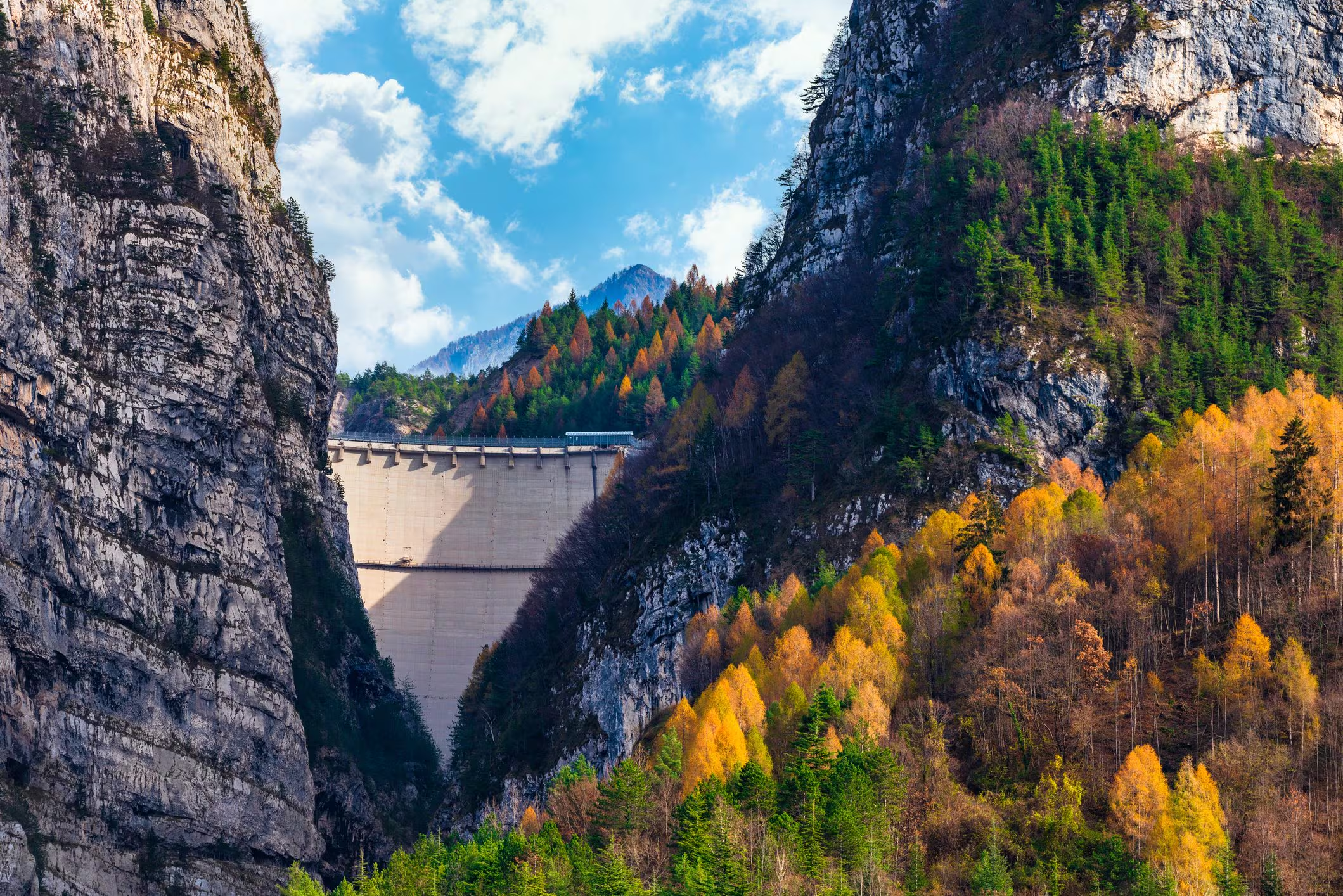
As highlighted by the INGV reconstructions, a huge block of ice would then have detached from a high-altitude glacier, falling for over a vertical kilometer to the bottom of the valley. The massive avalanche of ice and rock (more like a landslide) then hit the mountainside, falling into the Lhende Khola River, a tributary of the Bhote koshi and Trishuli rivers, two waterways that flow from China to Nepal often through deep gorges.
At that point, the temporary dam would have rapidly collapsed, releasing a wall of water, mud and heavy debris that violently devastated the mountain settlements downstream and the border structures, as confirmed by the images and videos published in the last few hours.
This is also why the systems of the National Institute of Geophysics and Volcanology did not locate this landslide event, although equivalent to a magnitude 5.2, which occurred in Nepal. The reasons, as experts explain, are mainly two: the great distance and the very nature of the signal, which is superficial and not impulsive and long-term, very different from the clear and sudden one of a real earthquake.
In any case, it will take several weeks to precisely reconstruct the entire dynamics of this disaster. Experts, however, point out that the hypothesis of heavy rains is unlikely: despite summer being the rainiest season of the year in this region (due to the monsoons), in the last week no rainfall heavy enough to cause a disaster of this magnitude has been recorded in the district.
The images of the flood: the comparison between before and after
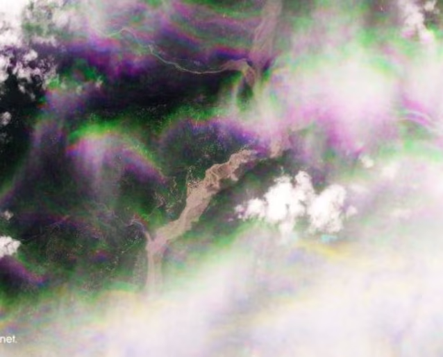
As anticipated, the death toll and damage is unfortunately dramatic: in the satellite images comparing the before and after, the wave of mud and debris is clearly visible. More specifically, these two shots show the town of Timure, in Nepal, about 3 kilometers from the Rasuwa border crossing that connects the country to Gyirong, on the Chinese side.
The first image, dating back to 23 August 2026, shows the town centre of Syabrubesi, in Rasuwa district.
The next one, taken on August 26, shows the river swollen and swollen, with the structures along the banks seriously damaged or swept away: Rasuwa is among the most affected areas.
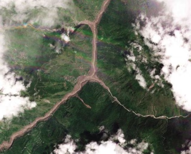
This second series of images, however, shows satellite footage of the Trishuli River at Chappthokealso in Nepal. The first image was taken on August 23rd.
In comparison, the image of the same place created by Planet Lab satellites on August 26, after the disaster.
The Nepalese army, meanwhile, has deployed 2,000 troops for land and air search and rescue operations in flood-hit areas to search for survivors. As reported by ICIMOD (International Center for Integrated Mountain Development), hydrological observations confirm the exceptional speed and extent of the flood wave. The water level of Trishuli river in Galchchi is said to have risen by as much as nine meters in 30 minutes, while in Malekhu the increase was seven meters in the same period.
Meanwhile, experts are also evaluating whether debris has temporarily blocked the river in a narrow section, forming a landslide dam: such a blockage could in fact create a secondary danger if the accumulated water were suddenly released.