According to the most recent report onUrban environment published by ISTAT, in the 109 Italian capital municipalities (where around 17.5 million people live, almost a third of the population) the overall extension of urban green areas exceeds 584 km²equal to 3% of the territory of the capitals and an average availability of 33.3 m² of greenery per inhabitant. Each of us should therefore have over 30 square meters of urban greenery, but often the closest park is a 20-minute walk away.
How much is 33 square meters? To give you an idea, it is the surface of a spacious studio apartment or a small two-room apartment; corresponds more or less 2 and a half parking spaces, 40 beach towels lying on the ground or 12 ping pong tables next to each other.
The minimum urban planning standard envisaged by Ministerial Decree 1444/1968 is 9 m² of equipped public green areas per inhabitant and 9 m²/inhabitant, so on paper each of us would be entitled to three times more than the minimum considered necessary. However, there is a problem: not all of this greenery is open to direct use by citizens and the truly accessible areas, excluding woods and protected areas, drop to 18.9 m² per inhabitant, i.e. almost 60% of the total. This gap between the greenery surveyed by the data and the greenery we can really benefit from is evident from the ISTAT data published in 2025 and referring to the year 2023.
The difference between available green and accessible green
ISTAT measures the urban greenery as the set of all the green areas managed by public bodies in the municipal territory: parks and gardens are included in the calculation, but also cemeteries, botanical gardens, wooded areas, uncultivated greenery and urban forestation areas (read: the new woods planted to absorb CO₂ and mitigate the heat). A part of these surfaces is not intended for citizens: a naturally developing urban forest or a protected area have ecological value, but are not a playground to bring children to.
For this reason the accessible urban greeneryi.e. areas open to the public without restrictions, generally excluding surfaces not accessible to the public, such as wooded areas, urban forestry and uncultivated greenery.
It is here that the national average figure is almost halved: from the theoretical 33.3 m² it drops to the actually livable 18.9 m². It is a significant difference, because when we talk about the benefits of urban greenery on our health – fewer heat islands, better air quality, more physical activity and psychological well-being – matters especially that the greenery is accessible and easily accessiblenot only that it exists in the municipal territory.
Accessible greenery: parks in first place, historic villas and neighborhood gardens
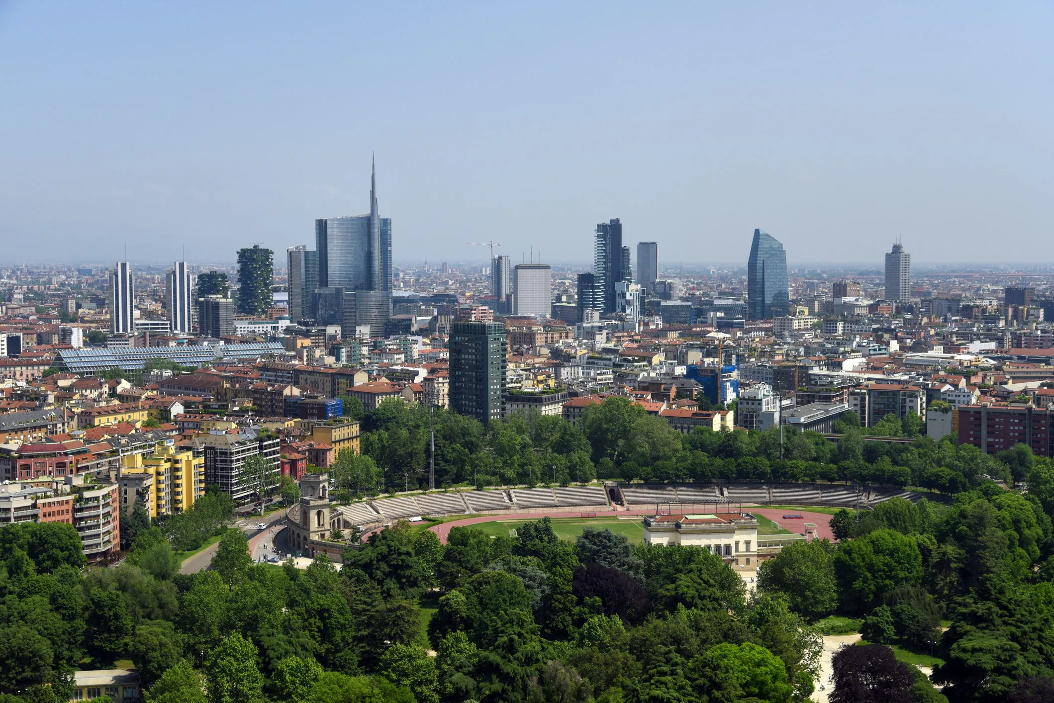
THE urban parks represent the 15.2% of greenery overall in the capitals, with almost 89 million m². In absolute value they dominate Rome (over 20 million m²) e Milan (9.4 million); in percentage terms, Gorizia and Cuneo are in the lead, where half of the city’s greenery is made up of parks.
Next we find the equipped green (10.6%), i.e. small parks and neighborhood gardens, with benches and play areas, and for the same surface area historic green (10.6%), which includes villas, parks and gardens of artistic interest protected by law, in which case the absolute record goes to Turinwith 8.4 million m².
Then there are the areas of urban furniture (8.9%, green spaces with aesthetic value), the outdoor sports areas (4.5%) ei school gardens (3.7%). All the rest (uncultivated greenery, wooded areas, urban forestry) contributes to making up the numbers but is generally not accessible, and in non-metropolitan capitals it covers more than half of the green surfaces (53.8%).
There is a voice that, despite not being “accessible”, is growing: the urban forestationi.e. the creation of new naturally developing forests in the city area, which contribute to the absorption of CO₂ and the mitigation of the effect of urban heat islands. In 2023 they rose to 62 capitals with forestation interventions completed or underway, for over 16 million m² in total, a theme supported by PNRR funds and concentrated above all in the North: 88.6 m² per hectare of urban surface in the North-East, compared to 11.7 in the South.
In the North-East there is more greenery, the Islands lag behind
The geography of urban greenery in Italy is not uniform: the highest allocation is recorded in the capitals of North-east, with 64 m² per inhabitantover triple the 20.8 m² of the Islandswhich close the ranking. North-West, Center and South are located around the national average.
The most surprising data, however, concerns the large cities: the 14 capital municipalities of the metropolitan cities (Turin, Genoa, Milan, Venice, Bologna, Florence, Rome, Naples, Bari, Reggio Calabria, Palermo, Messina, Catania and Cagliari) have just 20.1 m² of greenery available per inhabitantagainst i 48.1 m² of the capitals smaller. This happens because in large cities the same amount of greenery must be divided among many more people, and the space is contested by buildings. On averagethe larger, more densely urbanized cities they tend to have one lower availability of greenery per capita.
If we look only at accessible greenery, the picture is confirmed and in some ways worsened: let’s go 29.4 m² per inhabitant of the North-East to 19.4 in the North-West, up to 18.9 in the Center and alone 11.9 m² of the South. Here too, large cities offer 15.9 accessible m² per capita compared to 22.2 in other smaller capitals.
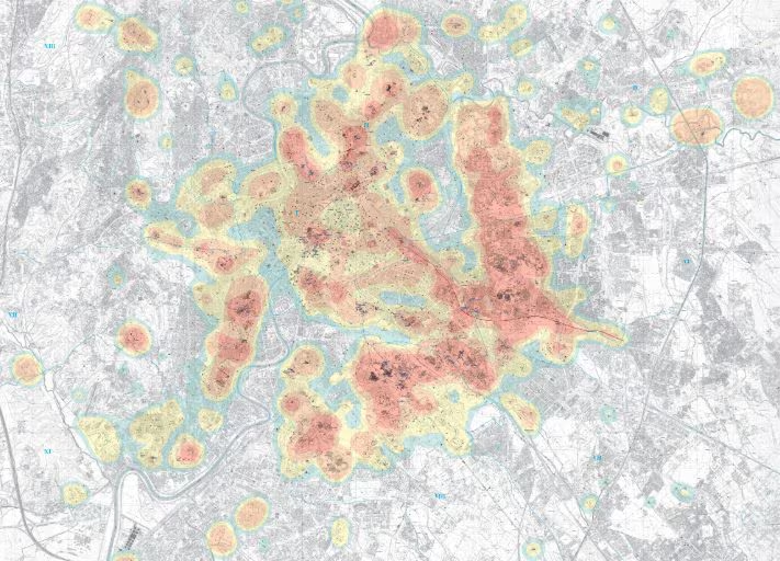
The map of the greenest cities and those where even the minimum legal requirements are missing
There is a minimum urban planning standard set by law: every citizen should have at least one available 9 m² of greenery (urban planning standard established by Ministerial Decree 1444/1968). It’s the space of a large bathroomor even less than one parking space: it’s a low minimum, yet in 10 capitals are not reached. These are Imperia, Savona, Chieti, Andria, Barletta, Trani, Crotone, Trapani, Messina and Syracuse.
At the other extreme there are hyper-green cities, those with more 100 m² of greenery per inhabitant: in the North they stand out Verbania, Sondrio, Trento, Bolzano and Gorizia; at the Center Terni and Rieti; to the South Isernia and Potenza. They are mostly small provincial capitals, often surrounded by hills and wooded areas, where a few inhabitants “share” a lot of greenery.
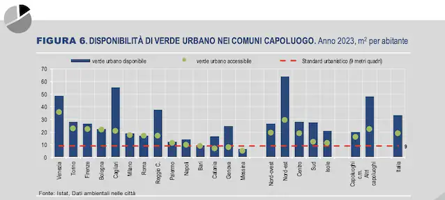
Among large cities, considering accessible greenery, the most virtuous are Venice and Turin (35.5 and 22.7 m² per inhabitant respectively), followed by Florence and Bologna (22.1 and 21.4). On the contrary, the data on green areas accessible to the public causes even large metropolitan capitals such as Genoa, Bari and Catania, which join the others, to slip below the minimum legal threshold.
Reggio Calabria and Matera: lots of greenery, almost all off-limits
To fully understand why “available” data can be deceiving, there are two perfect cities. In the years in which ISTAT published the rankings for single municipalities, prior to 2023, Reggio Calabria it was the metropolitan city with the highest availability of urban greenery in Italy: over 100 m² per inhabitant, triple the national average. A record that seems extraordinary, until you look at where that number comes from: a significant part of the municipal territory falls within the Aspromonte National Park.
It also happens to Materaalways at the top of the per capita greenery rankings with facilities that have reached 900 m² per inhabitant. Here too the reason is geographical: the famous one falls within the municipal area Natural historical archaeological park of the Rupestrian Churches of Materathe landscape of the Sassi, a unique natural and cultural heritage in the world, but again, it is not the equipped neighborhood park. It is exactly for this reason that ISTAT, alongside the raw data, calculates accessible greenery: so as not to make people believe that living in Matera or Reggio Calabria means having hundreds of square meters of public lawn within reach.
The paradox is that city like Genoa, Bari, Messina and Catania end up under the 9 m² of accessible greenery per capita by law despite often being a stone’s throw from hills, parks and coasts. But the forest on the promontory or the hill behind the city is not the garden where children play after school. And it is precisely the availability of nearby, level and equipped greenery that makes the difference in everyday life.
ISTAT data tell the story of a country that overall is investing in greenery: accessible areas have grown on average by 0.4% per year since 2011, and urban forestation is accelerating. However, there are two major fractures: that territorialbetween a very rich North-East and an area between the South and the Islands that remain behind, and the one between large cities and small townswith metropolises systematically poorer in usable greenery. The push also comes from Europe: the recent one Nature Restoration Lawthe law on nature restoration, provides, among its objectives, to avoid a net loss of urban green spaces compared to 2021 levels by 2030 and to progressively increase them in the following years.