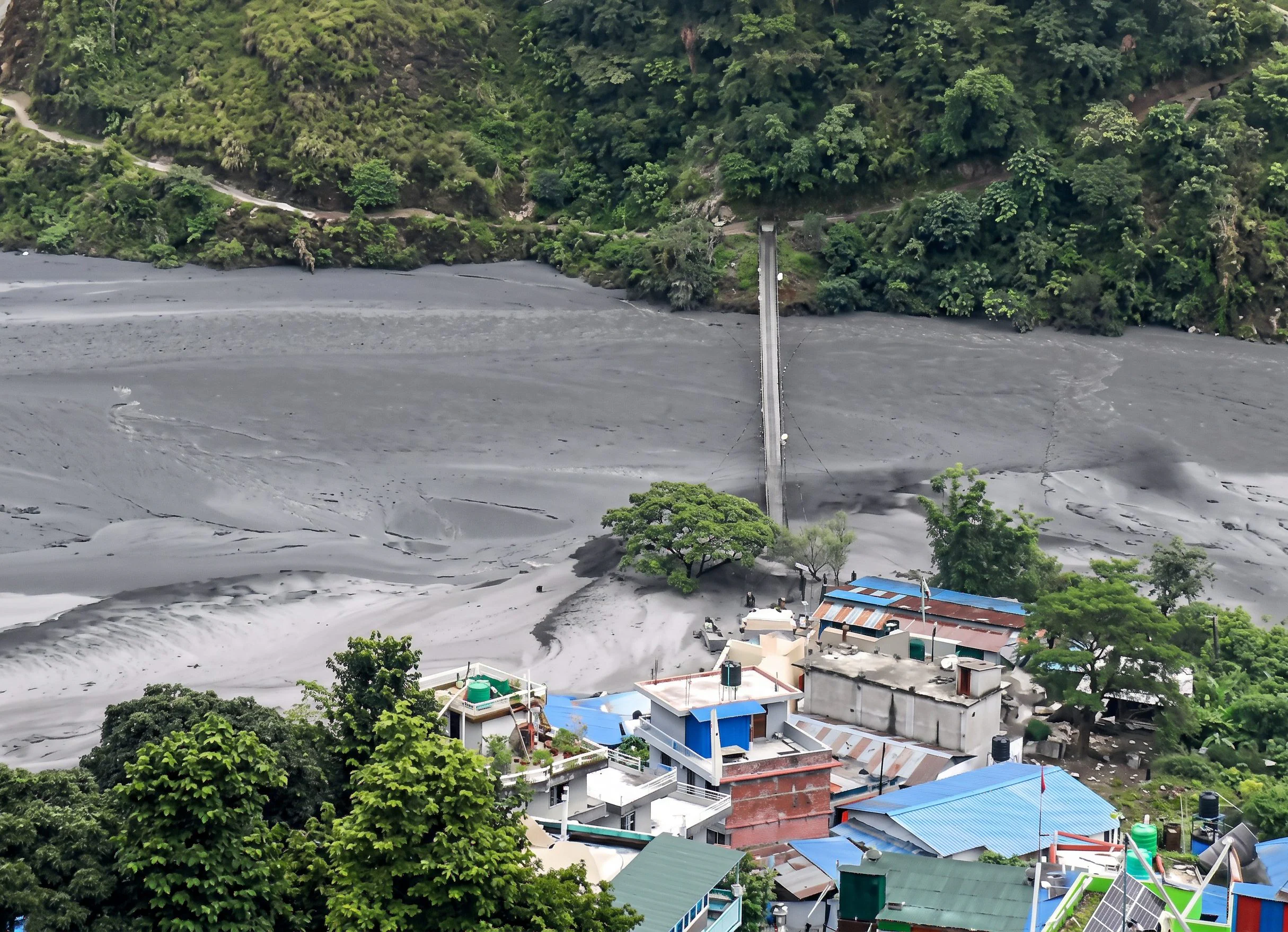
There has been a new flood in Nepal: a landslide in the village of Chumnubri, in the Gorkha district (about 100 km west of the capital Kathmandu) blocked the Budhi Gandaki river, causing floods downstream and overwhelming houses and infrastructure.
According to ICIMOD (International Center for Integrated Mountain Development), the disaster may have been caused by the failure of a temporary dam created after the landslide. The floods are estimated to have started on October 11 at around 4:00 am (00:15 local time in Italy), carrying mud, sediment and debris downstream along the Budhi Gandaki corridor.
The National Disaster Risk Reduction and Management Authority evacuated the villagers, warning people to move to safer areas via the SMS early warning system, sent to populations living along the Budhi Gandaki, Trishuli and Narayani river systems. The Budhi Gandaki is a tributary of the Trishuli River, downstream from another tributary where the collapse of a glacier last August caused a catastrophic flood.
At the moment, there are no confirmed victims, but 5 people are still missing: rescue services have confirmed that they have brought 95 people to safety, including some foreigners. Videos of the flood show houses and sheds swept away by the swollen river: the mudslide also damaged a highway bridge connecting Gorkha with the neighboring district of Dhading, as well as a 341 MW hydroelectric plant, with construction equipment swept away. According to officials, within a couple of hours the river’s water level rose from 2 meters to almost 8.5 metres.
Nepal is a country prone to natural disasters, from earthquakes to landslides and floods, due to the unpredictability of the Himalayan environment. This new flood comes less than two months after the tragic floods at the end of August, which devastated entire villages along the border between Nepal and Tibet, causing over 1,450 deaths (and thousands still missing). According to experts, however, the debris flow that has just occurred is much smaller than that of August and moved more slowly, allowing most of the inhabitants to find shelter in time.
The causes of that disaster are still to be ascertained. The collapse of a portion of the Langtang Lirung glacier caused a flow of mud and debris at around 180 km/h, but three hypotheses are still being evaluated as to the origin of the enormous volume of water: the GLOF (Glacial Lake Outburst Flood), i.e. the sudden emptying of a glacial lake, often held back by banks of ice or moraine debris, the blockage of the Lhende Khola river (and the formation of a temporary dam) or the mass of ice melt and sediment water.
Regardless, the government estimates that reconstruction will cost at least $4.77 billion, as nearly 33,000 people have been affected and approximately 7,500 homes have been damaged or destroyed. The flood of that time, as well as this more recent one, highlighted the vulnerability of settlements, transport networks, energy infrastructures and essential services located along mountain watercourses.
As relief operations continue, Nepalese authorities will need to better understand how slope instability, river dynamics and downstream exposure interact: as highlighted by ICIMOD, this will be critical for risk reduction, infrastructure planning and recovery interventions in the Himalayas.