The Niscemi landslide continues to advance: the town in the province of Caltanissetta, in Sicily, is still in the midst of an emergency after the landslide event that began last January 25, which led to over 1,500 displaced people. In fact, over the last few hours, new collapses preceded by explosions have been recorded, with the vertical shear reaching up to 55 metres.
At the moment, the red zone extends up to 150 meters from the landslide front, but the head of Civil Protection Fabio Ciciliano has the safety zone to retreat even further towards the city center, as the landslide is still active. The risk area, however, has been extended by approximately 25 km2on which a building ban will be imposed.
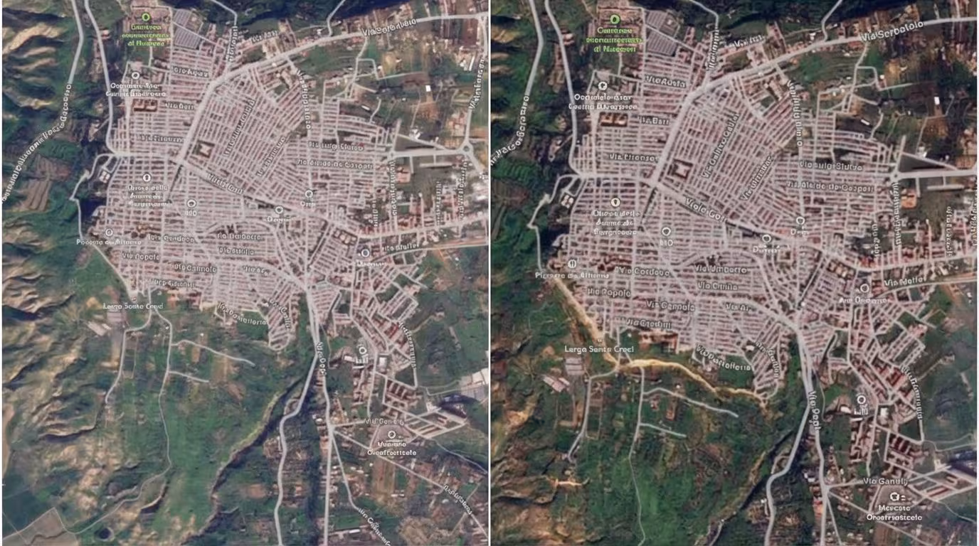
In the meantime, the Fire Brigade have released a video, visible above, which shows the Niscemi area before and after the landslide, created by the topography experts of the National Corps thanks to the use of satellite images. The comparison is impressive, with the images of the landslide over 4 km in extension clearly visible even from space.
To give an idea, Ciciliano compared the emergency in the Nisseno area to the Vajont disaster of 1963, when a landslide on Mount Toc ended up in the dam of the Friulian valley, triggering a flood that overwhelmed several towns below and caused 1,917 deaths and damages amounting to 900 billion lire. «Right now we are talking about a landslide which is approximately 350 million cubic metres. To make a comparison, the Vajont disaster of 1963 moved 263 million”, explained the head of Civil Protection. However, it should be remembered that the two disasters occurred in different situations and for different causes: in Niscemi, among other things, the disaster fortunately did not cause any deaths.
The geological reason why the landslide does not stop can be explained by looking at the stratigraphy of the area. A geological report presented to the Sicily Region in 2019 confirms that under the soil there is in fact a first layer of alluvial deposits due to the waterways present there, made of pebbles immersed in a poorly cemented matrix. Below, we find a layer of sand and a layer of silt before arriving at a substratum of marly clay. Higher states are porous, while clays are much less permeable.
But what will happen now? The Civil Protection has confirmed that citizens outside the red zone will not have to leave their homes and an investigation has been opened for negligent disaster and damage followed by a landslide. In the meantime, the ABI has suspended the mortgages of the homes involved; the government, however, rejected the use of funds for the construction of the Bridge over the Strait to deal with the damage in Niscemi and that caused by bad weather in Sicily and Calabria.